
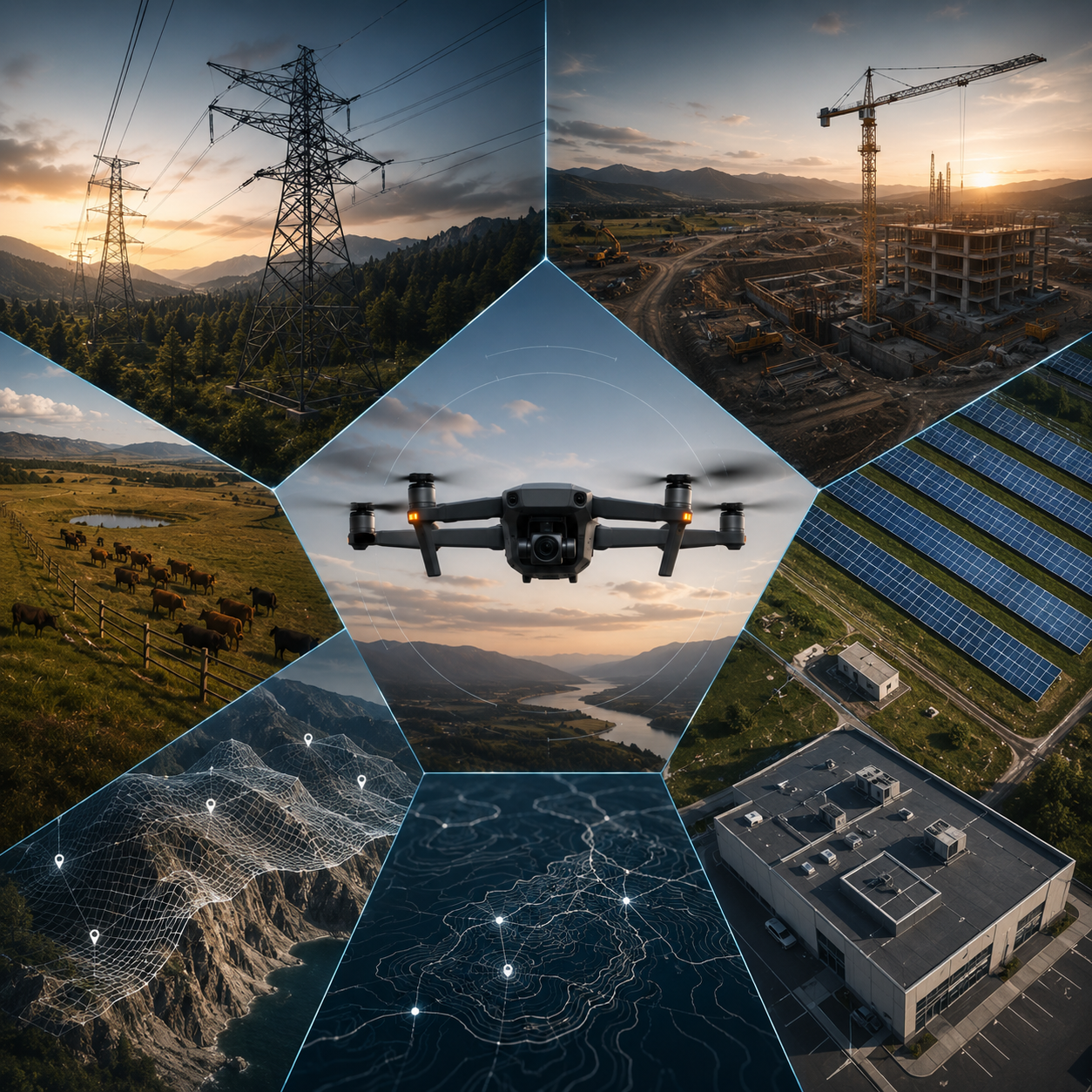
Explore Our SERVICES
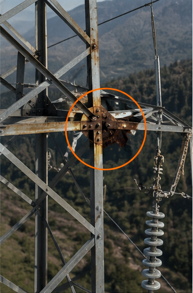
Waypoint Recon provides aerial inspection services for critical infrastructure, helping identify issues quickly, safely, and efficiently. Using high-resolution drone imagery, we assess assets such as power lines, transmission towers, substations, utility corridors, solar installations, communications equipment, bridges, and industrial facilities. Our inspections can reveal visible concerns including corrosion, damaged components, vegetation encroachment, erosion, structural deterioration, and other conditions that may impact reliability, safety, or operations—all without the need for costly manual inspections.
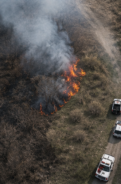
Waypoint Recon provides rapid aerial situational awareness to support public safety agencies, emergency managers, property owners, and response teams during critical events. Our drone operations can quickly assess storm damage, flooding, wildfires, search areas, infrastructure impacts, hazardous conditions, and access routes that may be difficult or unsafe to evaluate from the ground. By delivering real-time aerial imagery and comprehensive visual documentation, we help decision-makers gain a clearer understanding of evolving situations, improve resource allocation, and enhance overall response and recovery efforts.
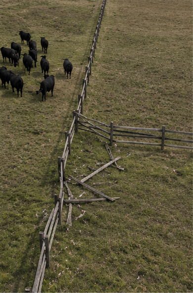
Waypoint Recon delivers aerial intelligence solutions that help ranchers, farmers, and land managers monitor large properties more efficiently. Our drone services can identify visible issues such as damaged fence lines, livestock location and movement, irrigation problems, water source conditions, storm damage, erosion, and access road deterioration. By providing a comprehensive aerial perspective, we help clients quickly assess conditions, prioritize maintenance, and make informed operational decisions while reducing the time and effort required for ground inspections.
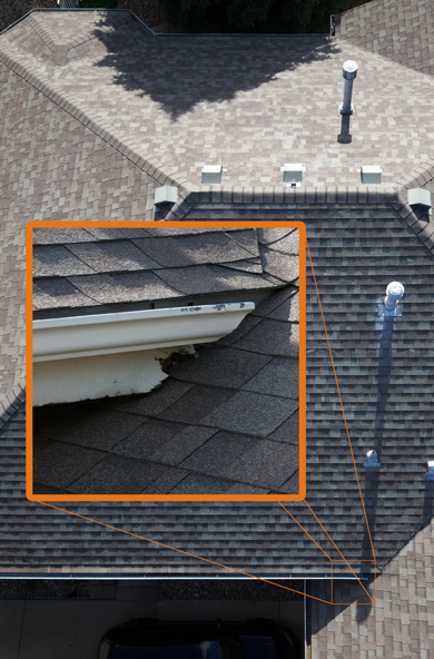
Waypoint Recon provides safe, efficient aerial roof inspections that eliminate the need for time-consuming and potentially hazardous manual roof access. Using high-resolution drone imagery, we can identify visible issues such as missing or damaged shingles, hail and storm damage, flashing defects, ponding water, drainage concerns, debris accumulation, and signs of general roof deterioration. Our detailed aerial assessments help property owners, facility managers, insurance professionals, and contractors make informed maintenance and repair decisions while reducing inspection costs and minimizing safety risks.
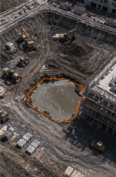
Waypoint Recon provides aerial construction intelligence that helps project teams track progress, improve visibility, and document site conditions from start to finish. Using high-resolution drone imagery and video, we capture comprehensive views of construction sites to identify visible issues such as drainage problems, material stockpile changes, site access concerns, safety hazards, erosion, and schedule-impacting delays. Our aerial documentation supports project managers, contractors, developers, and stakeholders with accurate visual records, progress updates, and actionable insights that help keep projects on schedule and informed decision-making on track.
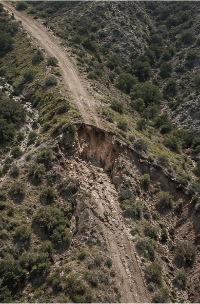
Not every challenge fits neatly into a standard inspection category. Waypoint Recon provides aerial reconnaissance and documentation services for unique, hard-to-reach, or large-area problems where an aerial perspective can deliver valuable insight. Our drone operations can assess remote road and trail conditions, erosion and washouts, culvert blockages, flood impacts, unauthorized dumping, property access issues, land disturbances, and terrain changes across large properties or recreational areas. Whether supporting landowners, ranch operators, property managers, HOAs, outdoor recreation groups, or infrastructure stakeholders, we help identify visible issues quickly and provide actionable imagery to support planning, maintenance, and decision-making.